
Energy Infrastructure from Remote Sensing Team Alpha
Estimate energy production from open data, and help to inform cantonal energy planning.
This group has been split into two subgroups; for the other subgroup, see Energy Infrastructure from Remote Sensing Team Beta
Challenge
The Canton Bern aims to reduce net greenhouse gas emissions to zero by 2050. Energy production from renewable resources will play a major part towards achieving this goal; therefore, new energy production infrastructure is built increasingly. Examples include solar panels or heat pumps. Depending on the project, such installations may not require administrative permission. This makes their installation more attractive, but makes it more difficult to know how much of the goal has already been achieved. From a planning perspective, it would be beneficial to know where solar panels and heat pumps are installed and have an indication about their production capacity. An ai tool based on open data (e.g. LIDAR, orthophoto or satellite data) would be a valuable contribution.
Image source: Bundesamt für Landestopografie swisstopo
Purpose
The aim of the project is to leverage open data, such as LIDAR and satellite imagery, to develop an AI model that can identify and quantify heat pumps installed in the canton. This will provide valuable in-sights for long-term energy planning and support the transition to more climate-friendly heating systems.
Common practices involve manual inspections and energy consumption data analysis. However, these methods are time-consuming and may not provide real-time or comprehensive data. The state-of-the-art in foundation models for this thematic area includes using computer vision and machine learning tech-niques to analyze aerial and satellite imagery for various urban planning purposes. However, specific applications for heat pump identification are less explored, while applications in the detection of solar panels are better established.
Inputs
This challenge involves the following steps:
- Data Collection: Gather and preprocess remote sensing data and information about current infrastructure locations.
- Model Development: Train an AI model to detect heat pumps or solar panels from collected data.
- Validation: Validate the model's accuracy using ground truth data.
- Energy Demand Assessment: Use the model's output to estimate the energy demand created by heat pumps or the production capacity of solar panels.
- Visualization: Create visualizations and dashboards to present the findings.
- Reporting: Document the process, results, and potential applications for energy planning.
Access to AI models and infrastructure will be crucial for executing these activities. This includes:
- Data Sources: Open remote sensing data. Federal info on currently existing infrastructure and their locations.
- AI Tools: Pre-trained models for object detection and image classification.
- Computing Resources: Cloud-based GPUs for model training and inference.
- Software: Python libraries for data processing and machine learning (e.g., TensorFlow, PyTorch).
A list of references can be found on this Zotero Bibliography. For a selection of useful open datasets, see Open Datasets section.
Outputs
This project will promote open science by making the AI model, data, and code publicly available. It will also support public policy by providing data-driven insights for energy planning and climate conscious-ness. The outcomes will catalyze a larger project by demonstrating the feasibility of using AI for energy infrastructure assessment, potentially leading to broader applications.
The proposed activities align with the goals of the Swiss AI Initiative by leveraging sovereign AI for sus-tainable energy planning. The strategic importance and potential impact of this project are significant for Swiss society, as it supports the transition to renewable energy sources and enhances energy planning capabilities. The insights gained can also be relevant for Europe and the world, promoting similar initia-tives in other regions.
Compliance
Ethical considerations include ensuring data privacy and accuracy, acknowledging all contributors, and sharing the results under a permissive license. Regulatory guidelines will be maintained by adhering to data protection laws and obtaining necessary permissions for data use. The project will follow the guidelines outlined in the FAQ of the Swiss {ai} Weeks to ensure ethical norms are upheld.
Open Datasets
- Cadastral Map
- Electricity Production Plants
- Federal Register of Buildings and Dwellings
- OpenAerialMap
- Recipients of Feed-in Remuneration at Cost
- Suitability of Roofs for the Use of Solar Energy
- swissALTI3D
- swissBOUNDARIES3D
- swissBUILDINGS3D 3.0 Beta
- SWISSIMAGE 10 Cm, Digital Orthophotomosaic of Switzerland
- swissSURFACE3D
- swissSURFACE3D Raster
🅰️ℹ️ Written with help from MISTRAL24B
swiss-ai-weeks
Hackathon
Run
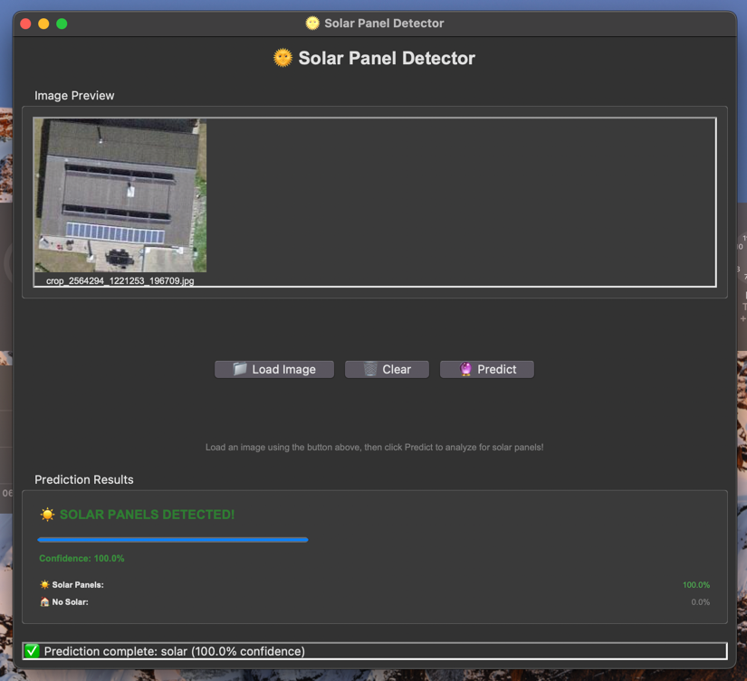
Run the gui_app.py file to test the model. But first you need to download the trained model.


Previous
Hackathon Bern
Next project